
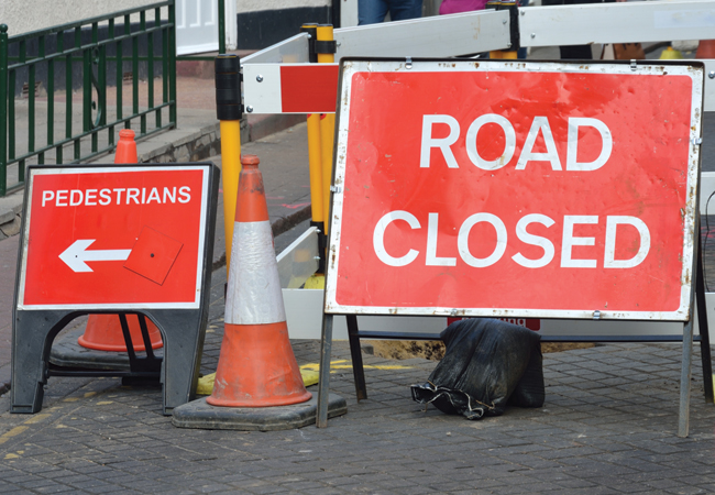
Credit PAUL WISHART / SHUTTERSTOCK
The UK has a vast network of utility and local authority infrastructure buried beneath its highways and footpaths. The combined network of water, sewer, gas and electricity services extends to more than 1.5 million km.
Data for telecommunication cables and local authority infrastructure, such as street lighting cabling and highway drains, are less widely known, but it is estimated that – when included – the total length of buried infrastructure is in excess of 4 million km – 10 times longer than the country’s road network.
To repair, maintain and upgrade this vast network, the utility industry carries out two million streetworks each year with about the same number undertaken by the highways authorities.
Currently, the most widely adopted solution for accessing these networks for repair, maintenance or upgrading is open excavation, which has changed little in 200 years, despite exponential growth in urban development and the number of utilities.
Streetworks using traditional trenching techniques disrupt, and often significantly damage, transport infrastructure
In addition, not knowing precisely where existing infrastructure is located can result in the digging of dry holes or inadvertent damage to other underground assets. This leads to delays, extra costs, disruption to the public and possible adverse effects on the environment.
Now factor in more than 100 utilities potentially digging up the road at the same time, and you have a hugely dysfunctional system. It’s uneconomical, socially disruptive and has an impact on the environment – in other words, unsustainable. Part of the solution is either to make the current situation more sustainable or to consider other ways.
Research started in the UK in the 1990s to develop technologies and techniques to show and accurately locate buried assets. Mapping the Underworld (MTU) started with the ‘bodyscanner’ vision (see Figure 1) and grew from much earlier activity funded by the Engineering and Physical Sciences Research Council (EPSRC)1 and industry2, culminating in the 2002 international workshop.
International interest
The 2004 Ideas Factory seeded an initiative that created wide national and international interest, and spawned both Vista, the MTU location project and the Oxems spin-off company3, which makes remotely detectable asset tags for new and repaired pipes. Importantly, it brought together an expert team that is now acknowledged to be the leader in geophysical techniques.
However, it is not only the location that is of interest when managing a buried asset, but also the condition of the asset. The latest initiative, known as Assessing the Underworld (ATU) advances the MTU initiative into a new sphere of influence – part of a 25-year vision to make streetworks more sustainable.
The physical condition of these assets is of crucial importance in determining what, and how severe, the severe the impact on each of the other infrastructures will be
It builds upon two existing MTU research themes, aiming to develop the means to locate, map in 3D and record the position of all buried utility assets without the need for excavation. The idea is to integrate this information with utility service company records into a single, integrated, searchable 3D model.
Streetworks using traditional trenching techniques disrupt, and often significantly damage, the transport infrastructure and ground on which it is sited. As a consequence, the ground and physical infrastructures – the utility service and surface transport – have an interdependent relationship. Intervene physically in one, and the others are almost inevitably affected in some way, either immediately or in the future.
The physical condition of these assets is of crucial importance in determining what, and how severe, the impact on each of the other infrastructures will be.
The relationship needs careful consideration. For example, a deteriorated pipeline – maybe because it is fractured, laterally displaced, corroded or holed – will give a response to the geophysical techniques different from that of a pristine pipe.
Similarly, wetting of the adjacent soil, or voids created by local erosion, caused by leakage from a water-bearing pipe, will result in a different ground response to unaltered natural soil or fill. Furthermore, a deteriorated road – which might be cracked, rutted, or suffer from a softened, waterlogged foundation – will give a different response from intact, coherent, properly drained road structural layers.
Deterioration of the physical infrastructure occurs at rates dependent on many factors: the loading it receives; time; the materials from which it is formed; and local environmental conditions, including climate, weather, water conditions and so on.
One of the key problems is that the utility infrastructure is unseen and one way to overcome this is to consider an alternative solution in the form of a multi-utility tunnel (MUT) where all of the utilities are housed together in an urban underground conduit. 4 (See figure 2).
Whatever solutions are ultimately adopted it is important to assess them in relation to sustainability and future resilience.
Assessing whether they will still work in the years ahead, depends on how we define and measure sustainability in the context of how utilities are provided, and what the future has in store. The former is being considered as part of ATU and the latter by the Urban Futures project (2008-2012), which developed four plausible futures scenarios against which the resilience of these solutions could be assessed.5
This resulted in the BRE publication of the Urban Futures method called Designing Resilient Cities.6 Current research, as part of the Liveable Cities project (2012 to 2017), looks at transforming the engineering of cities in a variety of ways and considers a range of outcomes – taking into account the physical solutions and the governance and policy requirements that allow us to get there. These may have a number of barriers to overcome, depending on where they are used.7, 8. These are pertinent when considering alternative ways of utility placement, including trenchless techniques and MUTs, within the context of a car-driven or car-free future city environment.
While the solutions described above are largely for the future, we still have to deal with traditional infrastructure designs. One key element of the work to date on detecting buried infrastructure has been the need for the development of standards.
In this respect, The Institution of Civil Engineers led the development of a Publicly Available Specification (PAS) through the British Standards Institution (BSI), resulting in the publication of PAS128: Specification for underground utility detection, verification and location.9
The aim of PAS128 is to classify different levels of utility survey, ensuring a consistent standard across the industry. This will allow those people involved in such surveying to tender for jobs on a level playing field – beneficial to both clients and the wider industry sector. This standard will help increase market confidence about not just the definition and delivery of the Subsurface Utility Engineering process, but also the further professionalism of the industry.
Nicole Metje is a senior lecturer in fluid dynamics and geotechnical engineering at the School of Civil Engineering, University of Birmingham, and a member of the ICE municipal expert and ICE geospatial panels
Dexter Hunt is Birmingham research fellow at the School of Civil Engineering, University of Birmingham
References
1. NETTWORK: Establishing UK’s Research Needs in Trenchless Technology. Proc. 23rd International Conference on Trenchless Installation of Utilities (No-Dig 2005), Rotterdam, The Netherlands,
C D F Rogers and D N Chapman
2 Locating Underground Plant and Equipment – Proposals for a Research Programme. UKWIR Report (Reference Number 03/WM/12/4), 45pp, M Burtwell et al
3 Oxems http://www.oxems.com/
4 D V L Hunt, D Nash, and Rogers, C D F (2014). Sustainable utility placement via multi-utility tunnels. Tunnelling and Underground Space Technology. 39, 15-26
5 Scenario Archetypes: Converging rather than Diverging Themes, (2012), Sustainability 4, 740-772, D V L Hunt et al, http://bit.ly/1zVoH5F
6 Designing Resilient Cities: A Guide to Good Practice, D R Lombardi, J M Leach, C D F Rogers and the Urban Futures Team, BRE, 2012
bit.ly/1zVnKue
7 Barriers to sustainable infrastructure in urban regeneration, Proceedings of the ICE Engineering Sustainability Volume 158 Issue 2, 67–81, 2005, DVL Hunt and CDF Rogers
bit.ly/1cs4j1t
8 Lombardi, D R, Caserio, M, Donovan, R, Hale, J, Hunt, D V L, Weingaertner, C, Barber, A, Bryson, J R, Coles, R, Gaterell, M, Jankovic, L, Jefferson, I, Sadler, J and Rogers C D F. (2011) Elucidating sustainability sequencing tensions and tradeoffs in development decision-making. Environmental Planning B. 38 (6), 1105 – 1121.
9 Specification for underground utility detection, verification and location bit.ly/1z0pdPF